190.72 miDistance
54,267 ftElevation gain
51,090 ftElevation loss
18 daysTime
This is another hike that had been on my radar all the way back in 2018 when I was first choosing which interntional backpacking trip I wanted to go on. But given the wide range of elevation changes, and the fact that I had never been on a mountain hike before, I opted for the flatter and more popular trek, the Camino.
Having done three thru-hikes to date, each within a variety of elevations and environments, I decided that I was ready to go on an adventure on the other side of the planet. It was a 15 hour plane ride from Chicago to China, and then a shorter 2 hour flight from there to Nepal.
I thought I was ready for the culture shock, but I was not. Nepal is such a different place than what I have previously experienced, and it took a couple of days to get used to it. However, I didn't have much time since I would be starting the trek the very next day!
After losing a North Face fleece in the domestic flights terminal (if you can call it that) at the Khatmandu airport, and a short one-hour propeller plane ride to Pokhara, I had finally arrived. Pokhara is the outdoor enthusiast place to be in Nepal due to its central location to the Himalays and other areas, and was to be my homebase while I was out in the mountains.
What is the Annapurna Circuit
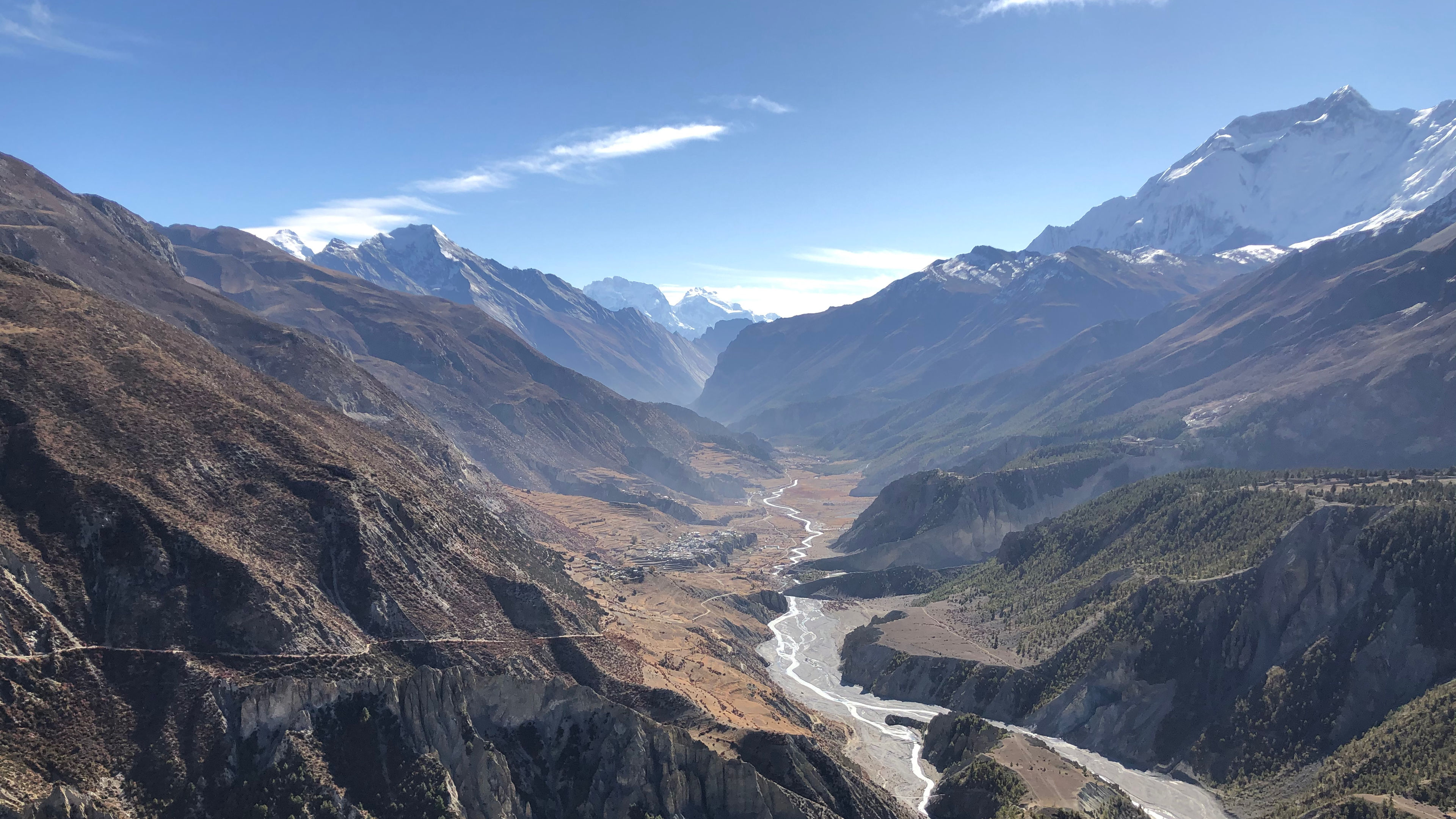
Within the Himalays in Nepal there is an area called the Annapurna Conservancy. It's a protected area of wilderness, almost like a national park. Entrance is monitored at various checkpoints by Nepalese military, and as a tourist you can only stay within the area for a limited amount of time (usually the amount of time it takes to do the entire circuit).
And within this Conservancy there is a trail known as the Annapurna Circuit. It's a circular route that goes around the Annapurna Mountain (one of the eight tallest peaks in the world). The trail gets it start in the subtropical forests along paddy fields and waterfalls at 2,500 feet, and ascends all the way up to the frozen Arctic region at 17,800 feet reaching the Tibetan plateau.
The whole circuit is about 145 miles in length, and it took me 13 days to complete it, even with some side treks mixed in. I went in a counter-clockwise direction because this way the daily altitude gain was slower, and it makes crossing the highest point easier and safer.
Where I spent each night
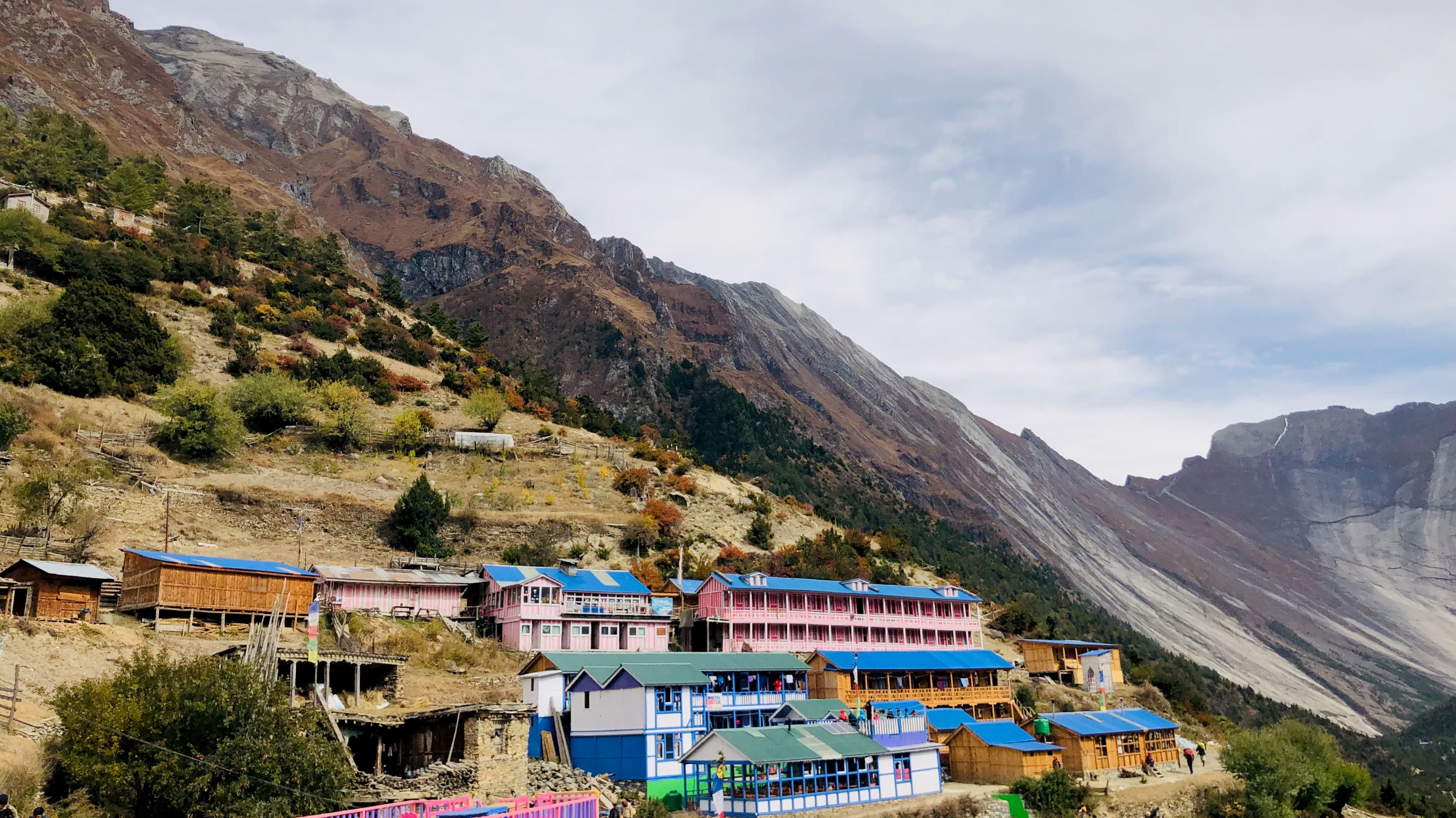
This trek was similar to the Camino de Santiago in terms of accommodations. Along the trail there are several small villages, each providing a handful of options to spend the night. The places to spend each night where called Tea Houses, and when you arrived you would ask how many beds were available, and then (the fun part) you start negotiating the price.
If you were a solo traveler, you probably didn't have much negotiating power. But, if you were part of a group (like I was) then you had some sway. You could, for example, offer to stay two nights at a discounted rate. And if you agreed to eat there, which you aren't required to do, you could get an even more discounted rate.
You could potentially talk them down from $20 a night (before including meals) to $10 a night! For a budget-concious traveler, this is a big win. On our first night we were able to share a room with three beds and a cot (since we were a group of four), and told them we would eat there. This brought it down to about $2 per person for the night.
What I brought
Seeing as this was my fourth thru-hike you would think that I would have made some gear changes by now, especially since this type of trek is something I had not done before, right? Wrong. I used the same gear from the Tour du Mont Blanc, but with some other gear thrown in that I already had lying around. Here are some essentials though:
- Sleeping bag
- Sleeping bag liner
- Large power bank
- Pillow
- Hut slippers
- Water filter
- Chlorine tablets
- Trekking poles
- Entertainment
- Warm fleece
- Down jacket
You go from a very warm climate to very cold climate in about a week, so you need to be prepared for both. This means both a bag liner for the warmer areas, and a warm sleeping bag for the colder ones. A large power bank is necessary since electricity might not always be available as you get higher up, and there are also frequent blackouts in the mountain villages.
Stages that I followed
Much like the Camino you didn't have to reserve anything in advance, which is nice. I like having the freedom to be able to go for as long as I want in a day. Having said that, there are some areas where it's not recommend you push yourself to go too far.
Day 01
Day 02
Day 03
Day 04
Day 05
Day 06
Day 07
Day 08
Day 09
Day 10
Day 11
Day 12
Day 13
Day 14
Day 15
Day 16
Day 17
Day 18
The Annapurna Circuit has been voted the best long-distance trek in the world as it combines a wide variety of climate zones from the tropics to the Arctic, and cultural variety from Hindu villages to the Tibetan culture.
This has been one of my most favorite places to be, right up there with Spain.

