10.52 miDistance
4,395 ftElevation gain
2,027 ftElevation loss
7 h 0 mTime
This was only the second day, and the second highest elevation point I’ve ever been to, so it was a rough hike up to the Col de la Croix. The pictures do not capture the steepness of the trail. I would be walking, hiking, and pulling myself up through all different types of things today.
Mountain sleeping is some of the best sleeping that I’ll ever have. My bunk was next to the door, so I had to contend with people going in and out to use the bathroom in the middle of the night, but the cold air helped me sleep. I also had an empty bunk next to me, so I didn’t have to worry about someone snoring in my face.
Since I stayed up high last night, I had to start the day by descending down 750 meters to the city of Les Contamines below. It only took about an hour and half to descend through the winding roads and twisting trails. I got lost twice as I tried to find my way into the city center.
The way out of town went through a forest that followed a river for most of the way. It was a shallow trail, not much gain in elevation. Saw one of the cutest houses that I’ve ever seen next to the chapel of Notre-Dame de la Gorge.
Here the trail started to go up, passing by various little waterfalls along the way. One of these watery distractions was a river of a deep blue that cut right down the middle of the forest through a canyon of its own design.
Several old buildings dotted the land around the trail as I continued on. I took a short breather at Refuge Nant Borrant since I had just climbed about 500 meters. From here on out the trail would become much steeper, and the elevation gain much more rapid.
Over the next hour I would hike along a gravel path, passing cows, red-roofed houses, rivers, and spotting what looked like the Torres del Paine in the distance (somehow I must have walked to Patagonia).
I met up with some folks from the night before at Refuge de la Balme (1760 meters) and we all started the next steep part together. It’s always a good idea to stop and turn around every so often though, because the views behind are almost just as amazing as the views ahead. I did this many times during the steep hike, simply because I wanted to see where I had come from. This helped put todays struggle into perspective.
We moved closer and closer to the clouds as we made the hike up to Col du Bonhomme. I got separated from the people I had been walking with (I can’t remember if I pulled ahead or fell behind), so I did the last couple of hours on my own.
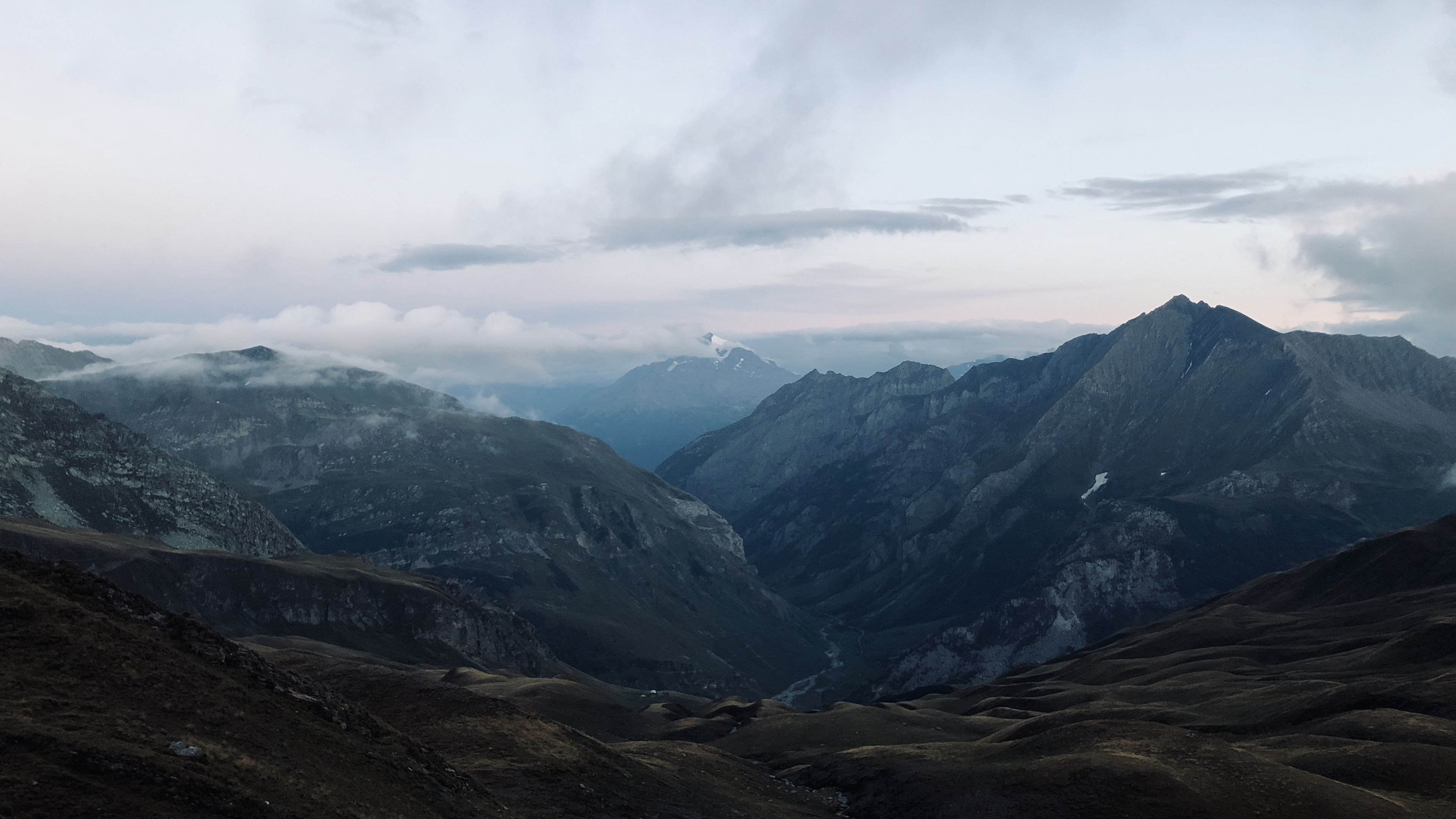
I didn’t spend much time here at this Col. It took 600 meters to get here, so I definitely took a bit of a break. I took a walk around the col, snapping pictures and admiring the view, but I knew that there was more in store for me and I would have to wait just a little bit longer on the “job well done”.
The next and final Col for the day was Col de la Croix.
Now came the boulders, steep drop-offs, and narrow paths. It took every last ounce of power that I had left to navigate these parts. I was in a no-fucking-around mood and did just that: powered through them.
The refuge for the night was a sight for sore (literally) eyes as I started the 40 meter descent towards it. I arrived just in time before the clouds rolled in and visibility dropped to zero.
Took my first cold shower tonight. What an experience that was. I’d rather go stinky than do a cold shower again.
This place also ran on solar power, and since it had been cloudy all day, that meant no lights which meant using your head torch to find your way around. But it also meant eating dinner by candlelight, not too bad. I hung out with some Israelis (Barak and Neta) before dinner, and some folks from the UK, Canada, Brazil, and Ireland during dinner.
Why is French bread so dry??
The setting sun lit up a mountain in the distance in soft purples, and the sky behind the hills opposite it in bright oranges.
Tomorrow would be the highest hike yet for me, and the most meters gained and lost so far, which could have been avoided had I known about a shortcut across the mountain top...

